
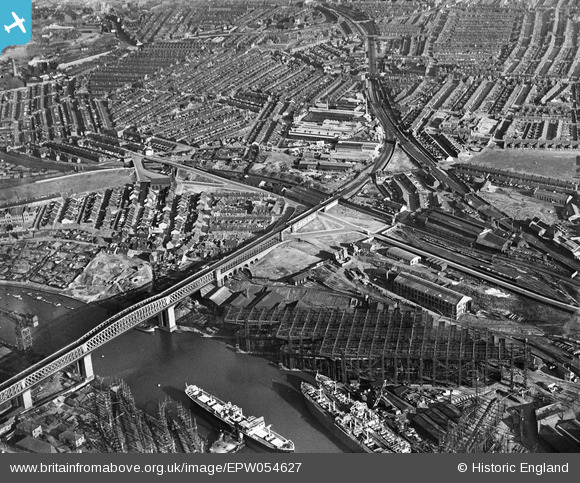
epw054627 ENGLAND (1937). Industrial and residential areas to the south of the Queen Alexandra Bridge, Millfield, 1937
© Copyright OpenStreetMap contributors and licensed by the OpenStreetMap Foundation. 2024. Cartography is licensed as CC BY-SA.
Nearby Images (14)
EPW054627

EPW054626

EPW057819

EPW054625

EPW054623

EPW054622

EPW054621

EPW054624

EPW057821

EAW003166
 alongside Queen Alexandra Bridge, Sunderland, 1946")
EPW054629

EPW054628

EAW003155
, Queen Alexandra Bridge and the surrounding area, Sunderland, 1946")
EPW040645

Details
| Title | [EPW054627] Industrial and residential areas to the south of the Queen Alexandra Bridge, Millfield, 1937 |
| Reference | EPW054627 |
| Date | 28-July-1937 |
| Link | |
| Place name | MILLFIELD |
| Parish | |
| District | |
| Country | ENGLAND |
| Easting / Northing | 438193, 557584 |
| Longitude / Latitude | -1.4041913067625, 54.911420345714 |
| National Grid Reference | NZ382576 |
Pins
 avocet |
Saturday 11th of March 2017 05:22:20 AM | |
avocet |
Saturday 11th of March 2017 05:14:44 AM | |
kevin n |
Thursday 9th of January 2014 06:15:23 PM | |
MB |
Wednesday 26th of June 2013 10:36:12 AM |


