
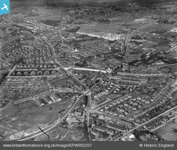
epw052157 ENGLAND (1936). Idle Road, Lister Lane, Harrogate Road and environs, Undercliffe, 1936. This image has been produced from a print.
© Copyright OpenStreetMap contributors and licensed by the OpenStreetMap Foundation. 2024. Cartography is licensed as CC BY-SA.
Details
| Title | [EPW052157] Idle Road, Lister Lane, Harrogate Road and environs, Undercliffe, 1936. This image has been produced from a print. |
| Reference | EPW052157 |
| Date | October-1936 |
| Link | |
| Place name | UNDERCLIFFE |
| Parish | |
| District | |
| Country | ENGLAND |
| Easting / Northing | 417763, 434755 |
| Longitude / Latitude | -1.7302238797848, 53.808569346652 |
| National Grid Reference | SE178348 |
Pins
 John N |
Saturday 24th of October 2020 12:57:47 AM | |
Val |
Saturday 26th of November 2016 02:52:12 PM | |
Val |
Saturday 26th of November 2016 02:51:34 PM | |
Val |
Saturday 26th of November 2016 02:50:39 PM | |
Photo framer |
Sunday 29th of November 2015 07:19:10 PM | |
Photo framer |
Sunday 29th of November 2015 07:16:27 PM | |
Photo framer |
Sunday 29th of November 2015 07:14:10 PM |


