
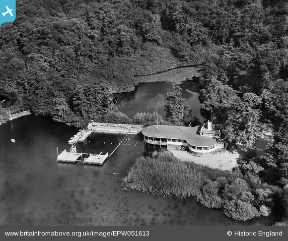
epw051613 ENGLAND (1936). The Laughing Waters Roadhouse, Shorne, 1936
© Copyright OpenStreetMap contributors and licensed by the OpenStreetMap Foundation. 2024. Cartography is licensed as CC BY-SA.
Details
| Title | [EPW051613] The Laughing Waters Roadhouse, Shorne, 1936 |
| Reference | EPW051613 |
| Date | August-1936 |
| Link | |
| Place name | SHORNE |
| Parish | SHORNE |
| District | |
| Country | ENGLAND |
| Easting / Northing | 567544, 169906 |
| Longitude / Latitude | 0.40900907822037, 51.402906878893 |
| National Grid Reference | TQ675699 |
Pins
Be the first to add a comment to this image!
User Comment Contributions
The Laughing Waters Roadhouse, Shorne, 1936 there is an entry in Wikipedia http://en.wikipedia.org/wiki/Gravesend_Airport. Accommodation was split between Cobham Hall (officers mess), the control tower (some pilots), and the 'Laughing Waters' restaurant. looking on Google maps there the Fish Ponds near the High speed rail track looks like the possible site. |
 Rudgey |
Thursday 24th of July 2014 03:24:52 PM |
Now the Inn on the Lake motel off the A2 |
Pglen |
Tuesday 21st of May 2013 10:08:24 AM |


