
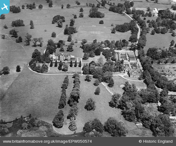
epw050574 ENGLAND (1936). Clayesmore School, Iwerne Minster, 1936
© Copyright OpenStreetMap contributors and licensed by the OpenStreetMap Foundation. 2024. Cartography is licensed as CC BY-SA.
Nearby Images (4)
EPW050574

EPW050577

EPW050579

EPW050580

Details
| Title | [EPW050574] Clayesmore School, Iwerne Minster, 1936 |
| Reference | EPW050574 |
| Date | June-1936 |
| Link | |
| Place name | IWERNE MINSTER |
| Parish | IWERNE MINSTER |
| District | |
| Country | ENGLAND |
| Easting / Northing | 386389, 114606 |
| Longitude / Latitude | -2.1937010611523, 50.93019460872 |
| National Grid Reference | ST864146 |
Pins
 |
 Class31 |
Friday 31st of January 2014 01:41:38 PM |


