
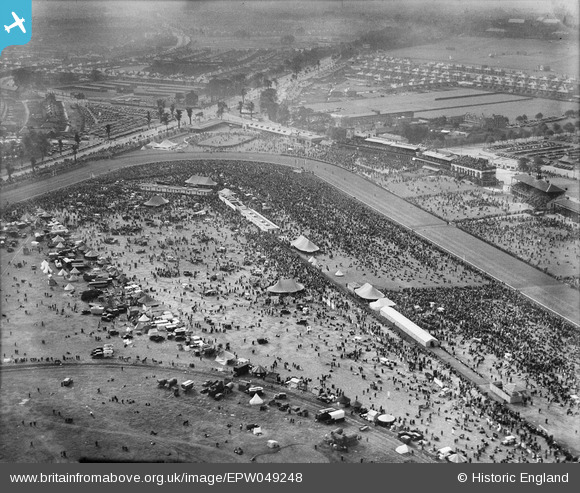
epw049248 ENGLAND (1935). Doncaster, Doncaster Racecourse on the day of the St Leger, 1935
© Copyright OpenStreetMap contributors and licensed by the OpenStreetMap Foundation. 2024. Cartography is licensed as CC BY-SA.
Nearby Images (11)
EPW049248

EAW049621

EAW049622

EPW049245

EPW016988

EPW049244

EAW049619

EPW049249

EAW049620

EPW049246

EPW049243

Details
| Title | [EPW049248] Doncaster, Doncaster Racecourse on the day of the St Leger, 1935 |
| Reference | EPW049248 |
| Date | 11-September-1935 |
| Link | |
| Place name | DONCASTER |
| Parish | |
| District | |
| Country | ENGLAND |
| Easting / Northing | 459587, 402969 |
| Longitude / Latitude | -1.1011769510513, 53.519763249665 |
| National Grid Reference | SE596030 |
Pins
 Billy Turner |
Monday 30th of November 2015 07:54:35 PM |


