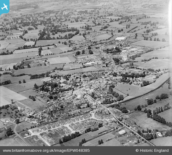
epw048385 ENGLAND (1935). The town, Melksham, from the south-east, 1935
© Copyright OpenStreetMap contributors and licensed by the OpenStreetMap Foundation. 2024. Cartography is licensed as CC BY-SA.
Nearby Images (3)
EPW048385

EPW041315

EPW048384

Details
| Title | [EPW048385] The town, Melksham, from the south-east, 1935 |
| Reference | EPW048385 |
| Date | July-1935 |
| Link | |
| Place name | MELKSHAM |
| Parish | MELKSHAM |
| District | |
| Country | ENGLAND |
| Easting / Northing | 390640, 163440 |
| Longitude / Latitude | -2.1344746679755, 51.36944448659 |
| National Grid Reference | ST906634 |
Pins
 Class31 |
Wednesday 24th of July 2013 04:27:55 PM | |
Class31 |
Wednesday 24th of July 2013 04:19:32 PM | |
Class31 |
Wednesday 24th of July 2013 04:17:20 PM | |
Class31 |
Wednesday 24th of July 2013 04:15:07 PM | |
Class31 |
Wednesday 24th of July 2013 04:12:45 PM | |
Class31 |
Sunday 30th of June 2013 06:37:22 PM | |
Class31 |
Sunday 30th of June 2013 06:35:51 PM |