
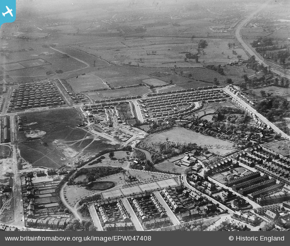
epw047408 ENGLAND (1935). Light Oaks Park, housing under construction along Burnside Avenue and environs, Salford, from the east, 1935
© Copyright OpenStreetMap contributors and licensed by the OpenStreetMap Foundation. 2024. Cartography is licensed as CC BY-SA.
Nearby Images (6)
EPW047408

EPW047403

EPW047406

EPW047407

EPW047411

EPW047404

Details
| Title | [EPW047408] Light Oaks Park, housing under construction along Burnside Avenue and environs, Salford, from the east, 1935 |
| Reference | EPW047408 |
| Date | May-1935 |
| Link | |
| Place name | SALFORD |
| Parish | |
| District | |
| Country | ENGLAND |
| Easting / Northing | 379230, 400169 |
| Longitude / Latitude | -2.3131321340985, 53.497561072136 |
| National Grid Reference | SD792002 |
Pins
 Lizzie |
Tuesday 3rd of October 2023 08:26:32 PM | |
Lizzie |
Tuesday 3rd of October 2023 08:24:57 PM | |
Lizzie |
Tuesday 3rd of October 2023 08:00:33 PM | |
Lizzie |
Tuesday 3rd of October 2023 08:00:05 PM | |
Lizzie |
Tuesday 3rd of October 2023 07:59:07 PM | |
Lizzie |
Tuesday 3rd of October 2023 07:46:58 PM | |
 JW |
Thursday 20th of November 2014 11:21:09 PM | |
JW |
Thursday 20th of November 2014 11:20:22 PM | |
JW |
Thursday 20th of November 2014 11:19:01 PM |


