
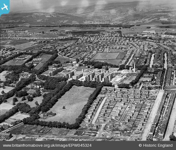
epw045324 ENGLAND (1934). The Bradford Royal Infirmary, Daisy Hill, from the south-east, 1934
© Copyright OpenStreetMap contributors and licensed by the OpenStreetMap Foundation. 2024. Cartography is licensed as CC BY-SA.
Nearby Images (2)
EPW045324

EPW045326

Details
| Title | [EPW045324] The Bradford Royal Infirmary, Daisy Hill, from the south-east, 1934 |
| Reference | EPW045324 |
| Date | July-1934 |
| Link | |
| Place name | DAISY HILL |
| Parish | |
| District | |
| Country | ENGLAND |
| Easting / Northing | 413698, 434217 |
| Longitude / Latitude | -1.791984620429, 53.803856260285 |
| National Grid Reference | SE137342 |
Pins
 Antony Partridge |
Wednesday 11th of January 2017 10:56:52 PM | |
Antony Partridge |
Wednesday 11th of January 2017 10:55:53 PM | |
Antony Partridge |
Wednesday 11th of January 2017 10:52:13 PM |
User Comment Contributions
Heights Lane Reservoir |
Antony Partridge |
Wednesday 11th of January 2017 10:54:27 PM |


