
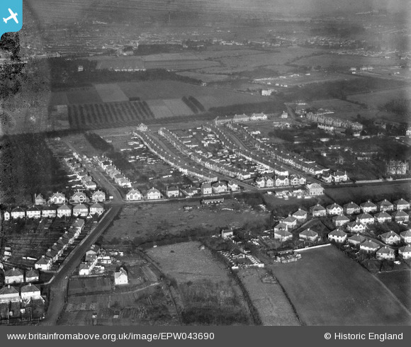
epw043690 ENGLAND (1934). Meadow Waye and environs, Heston, from the south, 1934
© Copyright OpenStreetMap contributors and licensed by the OpenStreetMap Foundation. 2024. Cartography is licensed as CC BY-SA.
Nearby Images (15)
EPW043690

EPW043691

EPW043693

EPW043704

EPW043706

EPW043705

EPW043708

EPW057931

EPW043710

EPW043707

EPW043687

EPW043689

EPW043688

EPW043692

EPW043709

Details
| Title | [EPW043690] Meadow Waye and environs, Heston, from the south, 1934 |
| Reference | EPW043690 |
| Date | January-1934 |
| Link | |
| Place name | HESTON |
| Parish | |
| District | |
| Country | ENGLAND |
| Easting / Northing | 512174, 177200 |
| Longitude / Latitude | -0.38438532883255, 51.482131232969 |
| National Grid Reference | TQ122772 |
Pins
 strtncll |
Sunday 7th of May 2023 12:10:22 PM | |
Isleworth1961 |
Tuesday 9th of December 2014 08:52:26 PM | |
Isleworth1961 |
Saturday 8th of June 2013 09:35:42 PM | |
Isleworth1961 |
Saturday 8th of June 2013 09:35:12 PM | |
Isleworth1961 |
Saturday 8th of June 2013 09:34:49 PM | |
Isleworth1961 |
Saturday 8th of June 2013 09:34:13 PM | |
Isleworth1961 |
Saturday 8th of June 2013 09:33:49 PM | |
Isleworth1961 |
Saturday 8th of June 2013 09:33:19 PM | |
Isleworth1961 |
Saturday 8th of June 2013 09:32:20 PM | |
Isleworth1961 |
Saturday 8th of June 2013 09:31:55 PM | |
Isleworth1961 |
Saturday 8th of June 2013 09:31:23 PM |


