
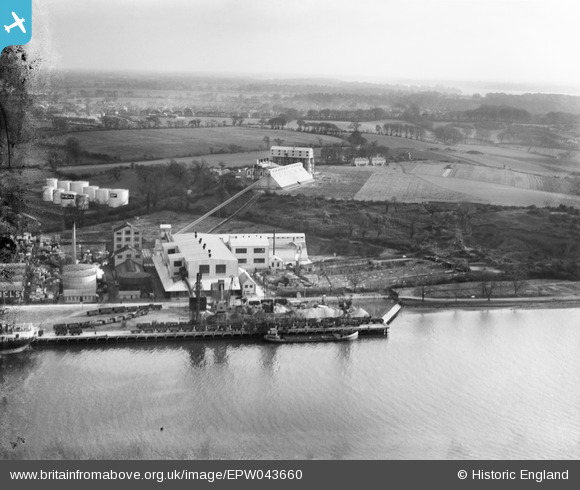
epw043660 ENGLAND (1933). Fison, Packard and Prentice at Cliff Quay and environs, Ipswich, from the north-west, 1933. This image has been produced from a damaged negative.
© Copyright OpenStreetMap contributors and licensed by the OpenStreetMap Foundation. 2024. Cartography is licensed as CC BY-SA.
Nearby Images (22)
EPW043660

EPW043663

EPW043659

EPW043658

EPW032854

EPW043657

EPW043661

EPW032839

EPW043662

EAW045635

EAW045637

EPW041402

EAW025118

EAW045628

EAW045632

EAW045633

EAW045634

EAW045629

EAW025117

EAW045636

EPW032846

EAW025121

Details
| Title | [EPW043660] Fison, Packard and Prentice at Cliff Quay and environs, Ipswich, from the north-west, 1933. This image has been produced from a damaged negative. |
| Reference | EPW043660 |
| Date | December-1933 |
| Link | |
| Place name | IPSWICH |
| Parish | |
| District | |
| Country | ENGLAND |
| Easting / Northing | 616752, 242649 |
| Longitude / Latitude | 1.1607902625595, 52.03937791464 |
| National Grid Reference | TM168426 |
Pins
Be the first to add a comment to this image!


