
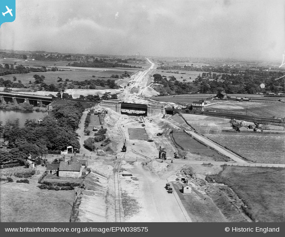
epw038575 ENGLAND (1932). The East Lancashire Road (A580) under construction at Carr Mill Railway Junction, St Helens, from the west, 1932
© Copyright OpenStreetMap contributors and licensed by the OpenStreetMap Foundation. 2024. Cartography is licensed as CC BY-SA.
Nearby Images (3)
EPW038575
 under construction at Carr Mill Railway Junction, St Helens, from the west, 1932")
EPW038574
 under construction at Carr Mill Railway Junction, St Helens, from the north-west, 1932")
EPW038573
 under construction at Carr Mill Railway Junction, St Helens, 1932")
Details
| Title | [EPW038575] The East Lancashire Road (A580) under construction at Carr Mill Railway Junction, St Helens, from the west, 1932 |
| Reference | EPW038575 |
| Date | June-1932 |
| Link | |
| Place name | ST HELENS |
| Parish | |
| District | |
| Country | ENGLAND |
| Easting / Northing | 352362, 397558 |
| Longitude / Latitude | -2.7177773905859, 53.472344097662 |
| National Grid Reference | SJ524976 |
Pins
 austin |
Thursday 11th of February 2021 08:27:27 PM | |
Joe Powell |
Thursday 8th of December 2016 03:56:51 PM | |
MB |
Tuesday 4th of October 2016 10:40:48 AM | |
el cyd |
Wednesday 24th of April 2013 10:46:41 PM |


