
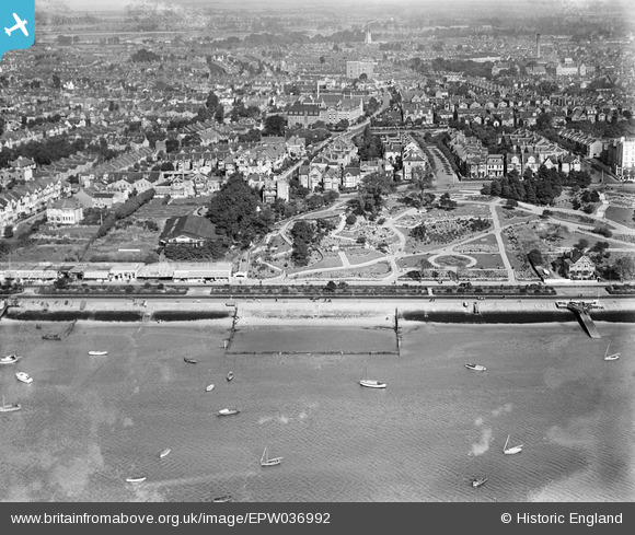
epw036992 ENGLAND (1931). The Padding Pool, The Cliffs and environs, Westcliff-on-Sea, from the south-west, 1931
© Copyright OpenStreetMap contributors and licensed by the OpenStreetMap Foundation. 2024. Cartography is licensed as CC BY-SA.
Nearby Images (17)
EPW036992

EPW024866

EPW037006

EPW054676

EPW039869

EPW036991

EPW036728

EPW036713

EPW058504

EPW000449

EPW000562

EPW040968

EPW040980

EPW036710

EAW053091

EPW024861

EPW000539

Details
| Title | [EPW036992] The Padding Pool, The Cliffs and environs, Westcliff-on-Sea, from the south-west, 1931 |
| Reference | EPW036992 |
| Date | October-1931 |
| Link | |
| Place name | WESTCLIFF-ON-SEA |
| Parish | |
| District | |
| Country | ENGLAND |
| Easting / Northing | 587190, 185082 |
| Longitude / Latitude | 0.69920573243943, 51.533083702305 |
| National Grid Reference | TQ872851 |
Pins
Be the first to add a comment to this image!


