
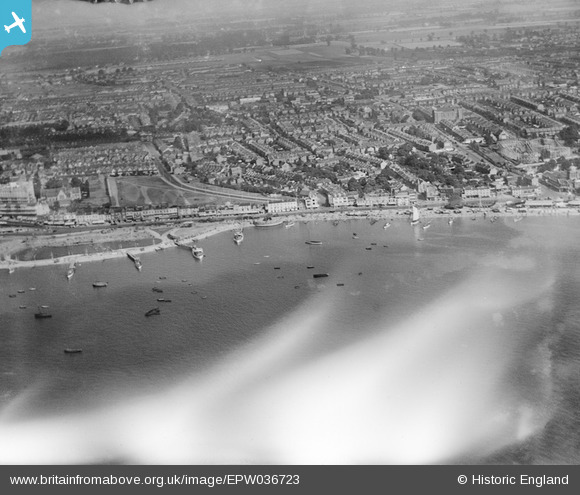
epw036723 ENGLAND (1931). The seafront, Marine Parade and the town, Southend-on-Sea, 1931. This image has been affected by flare.
© Copyright OpenStreetMap contributors and licensed by the OpenStreetMap Foundation. 2024. Cartography is licensed as CC BY-SA.
Nearby Images (37)
EPW036723

EPW016549

EPW037007

EPW000552

EAW002206

EPW058500

EPW054671

EPW040978

EPW040975

EPW037016

EAW053074

EPW037024

EPW036705

EAW002204

EAW002218

EPW054672

EPW062741

EPW058222

EAW002205

EPW000553

EPW062742

EAW002219

EAW024662

EPW000550

EAW002217

EPW024890

EPW058224

EAW026899

EPW000549

EPW036730

EAW002201

EAW026906

EPW062738

EPW000443

EPW010871

EPW036725

EPW037015

Details
| Title | [EPW036723] The seafront, Marine Parade and the town, Southend-on-Sea, 1931. This image has been affected by flare. |
| Reference | EPW036723 |
| Date | September-1931 |
| Link | |
| Place name | SOUTHEND-ON-SEA |
| Parish | |
| District | |
| Country | ENGLAND |
| Easting / Northing | 588776, 185025 |
| Longitude / Latitude | 0.72201701561591, 51.532043619593 |
| National Grid Reference | TQ888850 |
Pins
Be the first to add a comment to this image!


