
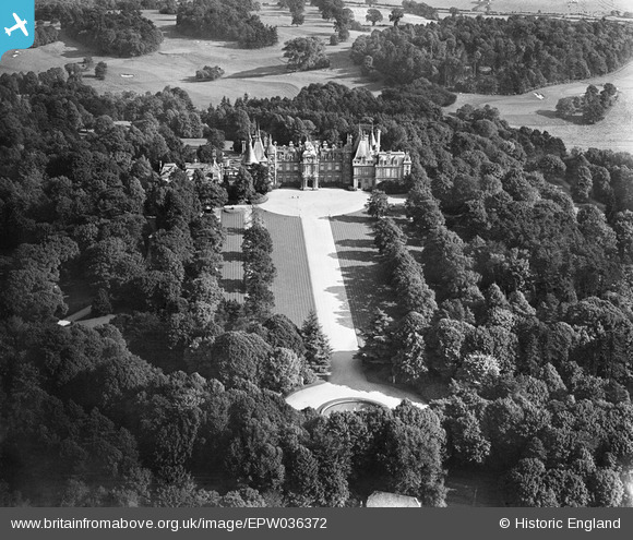
epw036372 ENGLAND (1931). Waddesdon Manor, Waddesdon, 1931
© Copyright OpenStreetMap contributors and licensed by the OpenStreetMap Foundation. 2024. Cartography is licensed as CC BY-SA.
Nearby Images (6)
EPW036372

EAW047975

EPW036374

EPW036373

EAW047977

EAW047976

Details
| Title | [EPW036372] Waddesdon Manor, Waddesdon, 1931 |
| Reference | EPW036372 |
| Date | August-1931 |
| Link | |
| Place name | WADDESDON |
| Parish | WADDESDON |
| District | |
| Country | ENGLAND |
| Easting / Northing | 473217, 216585 |
| Longitude / Latitude | -0.93708913508646, 51.842617494043 |
| National Grid Reference | SP732166 |
Pins
 John Llewellyn |
Monday 30th of November 2015 09:57:03 PM |
User Comment Contributions
 Waddesdon Manor, 30/03/2016 |
 Class31 |
Tuesday 5th of April 2016 03:53:47 PM |


