
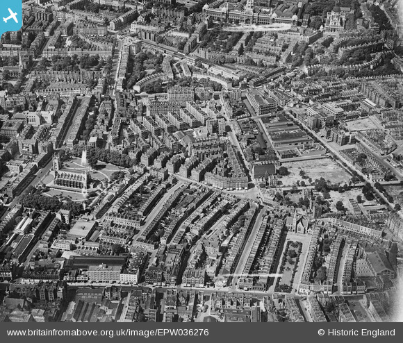
epw036276 ENGLAND (1931). St Luke's Church, Sutton Model Dwellings and environs, Chelsea, 1931
© Copyright OpenStreetMap contributors and licensed by the OpenStreetMap Foundation. 2024. Cartography is licensed as CC BY-SA.
Nearby Images (13)
EPW036276

EPW036271

EPW035607

EPW035605

EPW036275

EPW036273

EPW036274

EPW036270

EPW036272

EPW035606

EPW036269

EPW060779

EPW060784

Details
| Title | [EPW036276] St Luke's Church, Sutton Model Dwellings and environs, Chelsea, 1931 |
| Reference | EPW036276 |
| Date | August-1931 |
| Link | |
| Place name | CHELSEA |
| Parish | |
| District | |
| Country | ENGLAND |
| Easting / Northing | 527298, 178500 |
| Longitude / Latitude | -0.16620209132215, 51.490613359798 |
| National Grid Reference | TQ273785 |
Pins
 Class31 |
Tuesday 5th of August 2014 12:54:37 PM | |
 Alan McFaden |
Friday 18th of April 2014 10:34:09 PM | |
Alan McFaden |
Friday 18th of April 2014 10:33:09 PM | |
Alan McFaden |
Friday 18th of April 2014 10:32:15 PM | |
 jim |
Monday 10th of December 2012 08:03:58 PM |


.JPG?itok=DX928vYc)


