
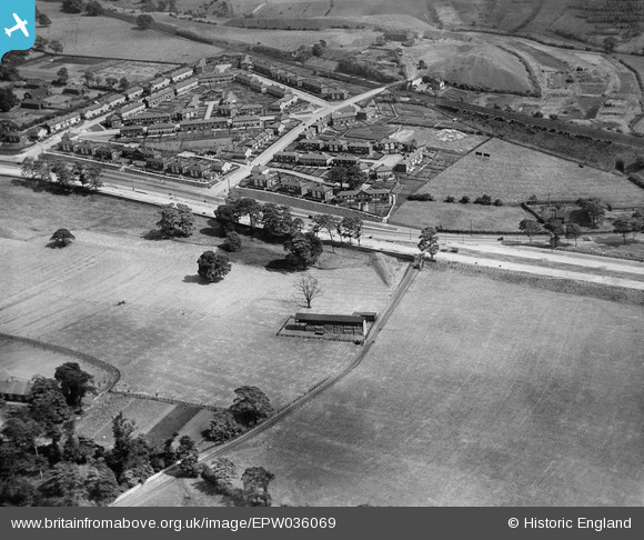
epw036069 ENGLAND (1931). Sutton Approach and environs, Killingbeck, 1931
© Copyright OpenStreetMap contributors and licensed by the OpenStreetMap Foundation. 2024. Cartography is licensed as CC BY-SA.
Nearby Images (8)
EPW036069

EPW036067

EPW036070

EPW036068

EPW036071

EPW036072

EPW036077

EPW036075

Details
| Title | [EPW036069] Sutton Approach and environs, Killingbeck, 1931 |
| Reference | EPW036069 |
| Date | 18-July-1931 |
| Link | |
| Place name | KILLINGBECK |
| Parish | |
| District | |
| Country | ENGLAND |
| Easting / Northing | 434300, 434357 |
| Longitude / Latitude | -1.4791206962906, 53.804164079171 |
| National Grid Reference | SE343344 |
Pins
 Carl |
Saturday 24th of February 2024 04:38:49 PM |


