
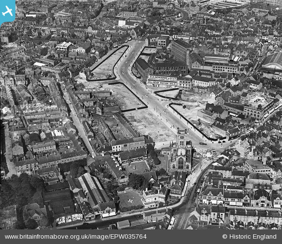
epw035764 ENGLAND (1931). Corporation Street, St John the Baptist's Church and environs, Coventry, 1931
© Copyright OpenStreetMap contributors and licensed by the OpenStreetMap Foundation. 2024. Cartography is licensed as CC BY-SA.
Nearby Images (34)
EPW035764

EPW035765

EPW035763

EPW001202

EAW024997

EAW024994

EPW035762

EAW001832

EAW024990

EAW031592

EAW030280

EPW001199

EAW024991

EAW001834

EAW031596

EAW031595

EAW031593

EAW024989

EAW025001

EAW031597

EAW031594

EAW024993

EAW024998

EAW001828

EAW024999

EPW053103

EPW061105

EAW025000

EPW047173

EAW024996

EAW024992

EAW025002

EPW061111

EAW051852

Details
| Title | [EPW035764] Corporation Street, St John the Baptist's Church and environs, Coventry, 1931 |
| Reference | EPW035764 |
| Date | 1-July-1931 |
| Link | |
| Place name | COVENTRY |
| Parish | |
| District | |
| Country | ENGLAND |
| Easting / Northing | 433124, 279155 |
| Longitude / Latitude | -1.5129995369203, 52.409017547545 |
| National Grid Reference | SP331792 |


