
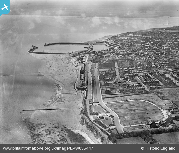
epw035447 ENGLAND (1931). Winterstoke Gardens, Ramsgate Sands, the Royal Harbour and the town, Ramsgate, 1931
© Copyright OpenStreetMap contributors and licensed by the OpenStreetMap Foundation. 2025. Cartography is licensed as CC BY-SA.
Nearby Images (18)
EPW035447

EPW000597

EPW052886

EPW000698

EPW035446

EPW000373

EPW000702

EPW039323

EAW009003

EPW039395

EPW048781

EAW009012

EAW009011

EAW009063

EPW048782

EAW009013

EAW009002

EAW017590

Details
| Title | [EPW035447] Winterstoke Gardens, Ramsgate Sands, the Royal Harbour and the town, Ramsgate, 1931 |
| Reference | EPW035447 |
| Date | May-1931 |
| Link | |
| Place name | RAMSGATE |
| Parish | RAMSGATE |
| District | |
| Country | ENGLAND |
| Easting / Northing | 638878, 165203 |
| Longitude / Latitude | 1.4298348285225, 51.335145296942 |
| National Grid Reference | TR389652 |
Pins
 Alan McFaden |
Monday 13th of October 2014 10:10:32 AM | |
Alan McFaden |
Monday 13th of October 2014 10:10:00 AM | |
Alan McFaden |
Monday 13th of October 2014 10:09:38 AM | |
Alan McFaden |
Monday 13th of October 2014 10:08:50 AM |


