
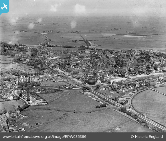
epw035366 ENGLAND (1931). The town, Rye, from the west, 1931
© Copyright OpenStreetMap contributors and licensed by the OpenStreetMap Foundation. 2024. Cartography is licensed as CC BY-SA.
Details
| Title | [EPW035366] The town, Rye, from the west, 1931 |
| Reference | EPW035366 |
| Date | 25-May-1931 |
| Link | |
| Place name | RYE |
| Parish | RYE |
| District | |
| Country | ENGLAND |
| Easting / Northing | 591291, 120073 |
| Longitude / Latitude | 0.72353866658225, 50.947758616966 |
| National Grid Reference | TQ913201 |
Pins
 Kylix |
Friday 10th of December 2021 09:26:03 PM | |
glennhughz |
Wednesday 9th of April 2014 05:28:12 PM | |
whiffler |
Saturday 18th of May 2013 09:15:35 PM | |
whiffler |
Saturday 18th of May 2013 09:15:34 PM | |
whiffler |
Saturday 18th of May 2013 09:14:26 PM | |
 Class31 |
Thursday 24th of January 2013 10:05:16 PM |


