
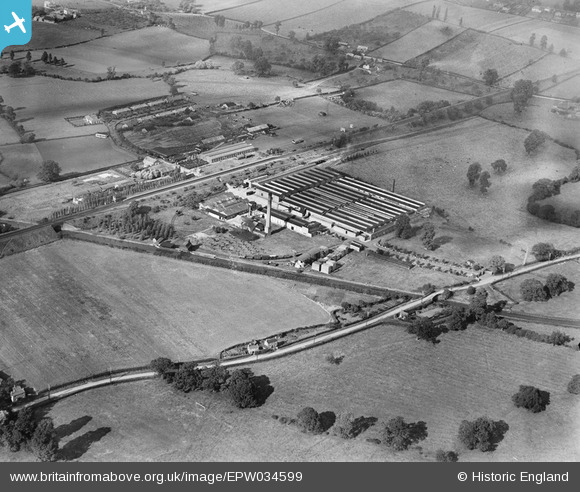
epw034599 ENGLAND (1930). Cadbury's Blackpole Chocolate Works and environs, Blackpole, 1930
© Copyright OpenStreetMap contributors and licensed by the OpenStreetMap Foundation. 2024. Cartography is licensed as CC BY-SA.
Nearby Images (8)
EPW034599

EPW034588

EPW034590

EPW034593

EPW034598

EPW034591

EPW034595

EPW034592

Details
| Title | [EPW034599] Cadbury's Blackpole Chocolate Works and environs, Blackpole, 1930 |
| Reference | EPW034599 |
| Date | August-1930 |
| Link | |
| Place name | BLACKPOLE |
| Parish | |
| District | |
| Country | ENGLAND |
| Easting / Northing | 386604, 257703 |
| Longitude / Latitude | -2.1961015669626, 52.21697703837 |
| National Grid Reference | SO866577 |


