
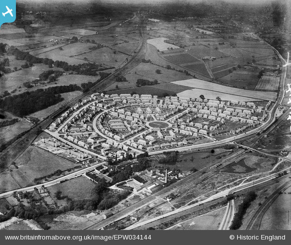
epw034144 ENGLAND (1930). The Bulwell Hall Estate, Bulwell, 1930
© Copyright OpenStreetMap contributors and licensed by the OpenStreetMap Foundation. 2025. Cartography is licensed as CC BY-SA.
Nearby Images (21)
EPW034144

EPW034139

EPW034138

EPW020739

EPW034137

EPW034146

EPW020741

EAW038724

EPW034148

EAW038725

EPW020743

EPW034147

EPW034149

EPW020737

EPW020740

EPW034140

EPW034145

EPW034141

EPW034135

EPW020742

EPW034142

Details
| Title | [EPW034144] The Bulwell Hall Estate, Bulwell, 1930 |
| Reference | EPW034144 |
| Date | July-1930 |
| Link | |
| Place name | BULWELL |
| Parish | |
| District | |
| Country | ENGLAND |
| Easting / Northing | 454327, 346699 |
| Longitude / Latitude | -1.1901255478085, 53.014527744152 |
| National Grid Reference | SK543467 |
Pins
Be the first to add a comment to this image!