
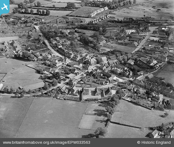
epw033563 ENGLAND (1930). School Road and environs, Gillingham, 1930
© Copyright OpenStreetMap contributors and licensed by the OpenStreetMap Foundation. 2024. Cartography is licensed as CC BY-SA.
Nearby Images (5)
EPW033563

EPW023223

EPW023216

EPW033729

EPW023217

Details
| Title | [EPW033563] School Road and environs, Gillingham, 1930 |
| Reference | EPW033563 |
| Date | July-1930 |
| Link | |
| Place name | GILLINGHAM |
| Parish | GILLINGHAM |
| District | |
| Country | ENGLAND |
| Easting / Northing | 381004, 126458 |
| Longitude / Latitude | -2.2709551026923, 51.036629781561 |
| National Grid Reference | ST810265 |
Pins
 Jaz |
Saturday 18th of May 2013 10:24:18 PM | |
Jaz |
Saturday 18th of May 2013 10:23:30 PM | |
Jaz |
Saturday 18th of May 2013 10:22:46 PM | |
Jaz |
Saturday 18th of May 2013 10:21:55 PM | |
Jaz |
Saturday 18th of May 2013 10:20:35 PM | |
Jaz |
Saturday 18th of May 2013 10:19:52 PM | |
Jaz |
Saturday 18th of May 2013 10:18:50 PM | |
Jaz |
Saturday 18th of May 2013 10:18:25 PM |


