
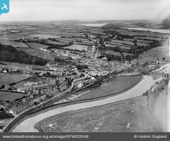
epw033048 ENGLAND (1930). The railway station, town and surrounding countryside, Wadebridge, from the east, 1930
© Copyright OpenStreetMap contributors and licensed by the OpenStreetMap Foundation. 2024. Cartography is licensed as CC BY-SA.
Nearby Images (4)
EPW033048

EPW039815

EPW033052

EPW039812

Details
| Title | [EPW033048] The railway station, town and surrounding countryside, Wadebridge, from the east, 1930 |
| Reference | EPW033048 |
| Date | July-1930 |
| Link | |
| Place name | WADEBRIDGE |
| Parish | WADEBRIDGE |
| District | |
| Country | ENGLAND |
| Easting / Northing | 199263, 72198 |
| Longitude / Latitude | -4.831786748052, 50.514504789882 |
| National Grid Reference | SW993722 |
Pins
 ronS |
Saturday 24th of August 2013 02:20:55 AM | |
ronS |
Saturday 24th of August 2013 02:17:46 AM | |
ronS |
Saturday 24th of August 2013 02:15:02 AM | |
ronS |
Saturday 24th of August 2013 02:14:32 AM | |
ronS |
Saturday 24th of August 2013 02:13:27 AM | |
ronS |
Saturday 24th of August 2013 02:12:56 AM |


