
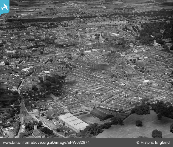
epw032874 ENGLAND (1930). The town, Ipswich, from the east, 1930
© Copyright OpenStreetMap contributors and licensed by the OpenStreetMap Foundation. 2024. Cartography is licensed as CC BY-SA.
Nearby Images (6)
EPW032874

EPW005254

EPW001830

EPW049137

EPW032834

EPW032830

Details
| Title | [EPW032874] The town, Ipswich, from the east, 1930 |
| Reference | EPW032874 |
| Date | June-1930 |
| Link | |
| Place name | IPSWICH |
| Parish | |
| District | |
| Country | ENGLAND |
| Easting / Northing | 617132, 244247 |
| Longitude / Latitude | 1.1673375847434, 52.053575969586 |
| National Grid Reference | TM171442 |
Pins
 pf329 |
Wednesday 27th of August 2014 03:05:59 PM | |
pf329 |
Wednesday 27th of August 2014 03:04:59 PM | |
pf329 |
Wednesday 27th of August 2014 03:00:26 PM | |
pf329 |
Wednesday 27th of August 2014 03:00:04 PM | |
pf329 |
Wednesday 27th of August 2014 02:54:13 PM | |
pf329 |
Wednesday 27th of August 2014 02:53:32 PM | |
pf329 |
Wednesday 27th of August 2014 02:52:39 PM | |
pf329 |
Wednesday 27th of August 2014 02:49:41 PM | |
pf329 |
Wednesday 27th of August 2014 02:47:01 PM | |
pf329 |
Wednesday 27th of August 2014 02:45:19 PM |


