
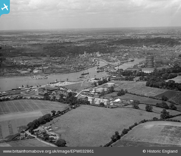
epw032861 ENGLAND (1930). The docks and town, Ipswich, from the south-east, 1930
© Copyright OpenStreetMap contributors and licensed by the OpenStreetMap Foundation. 2024. Cartography is licensed as CC BY-SA.
Nearby Images (15)
EPW032861

EPW032862

EPW032852

EPW032831

EPW032842

EPW032838

EPW032848

EAW045630

EAW045631

EPW032846

EAW025119

EAW025120

EPW032847

EAW025116

EAW025122

Details
| Title | [EPW032861] The docks and town, Ipswich, from the south-east, 1930 |
| Reference | EPW032861 |
| Date | June-1930 |
| Link | |
| Place name | IPSWICH |
| Parish | |
| District | |
| Country | ENGLAND |
| Easting / Northing | 617247, 242568 |
| Longitude / Latitude | 1.1679452312825, 52.038456989746 |
| National Grid Reference | TM172426 |
Pins
Be the first to add a comment to this image!


