
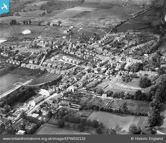
epw032132 ENGLAND (1930). The town centre, Orpington, 1930
© Copyright OpenStreetMap contributors and licensed by the OpenStreetMap Foundation. 2024. Cartography is licensed as CC BY-SA.
Nearby Images (9)
EPW032132

EPW032128

EPW032121

EPW032120

EPW032118

EPW032130

EPW032116

EPW032122

EPW032124

Details
| Title | [EPW032132] The town centre, Orpington, 1930 |
| Reference | EPW032132 |
| Date | May-1930 |
| Link | |
| Place name | ORPINGTON |
| Parish | |
| District | |
| Country | ENGLAND |
| Easting / Northing | 546357, 166574 |
| Longitude / Latitude | 0.10323733462727, 51.378827528519 |
| National Grid Reference | TQ464666 |
Pins
 Freefall |
Monday 28th of November 2016 02:20:17 PM | |
FlyingWombat |
Wednesday 5th of March 2014 07:22:40 AM | |
D.Daws |
Thursday 20th of February 2014 12:56:14 PM | |
D.Daws |
Thursday 20th of February 2014 12:55:36 PM | |
Buzby9 |
Friday 23rd of August 2013 10:16:17 PM |


