
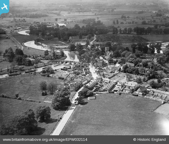
epw032114 ENGLAND (1930). Forstal Road and the village, Aylesford, 1930
© Copyright OpenStreetMap contributors and licensed by the OpenStreetMap Foundation. 2024. Cartography is licensed as CC BY-SA.
Nearby Images (13)
EPW032114

EPW038096

EAW048694

EAW048695

EPW038104

EPW038105

EAW048696

EPW038100

EPW032111

EPW032112

EPW038101

EPW038099

EPW032113

Details
| Title | [EPW032114] Forstal Road and the village, Aylesford, 1930 |
| Reference | EPW032114 |
| Date | May-1930 |
| Link | |
| Place name | AYLESFORD |
| Parish | AYLESFORD |
| District | |
| Country | ENGLAND |
| Easting / Northing | 572991, 158961 |
| Longitude / Latitude | 0.48192814651928, 51.302938794098 |
| National Grid Reference | TQ730590 |
Pins
Be the first to add a comment to this image!


