
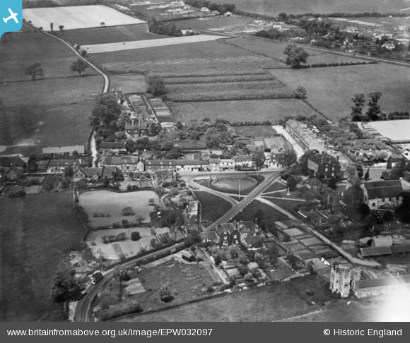
epw032097 ENGLAND (1930). Otford Palace and the village, Otford, from the south, 1930.. This image has been produced from a print.
© Copyright OpenStreetMap contributors and licensed by the OpenStreetMap Foundation. 2024. Cartography is licensed as CC BY-SA.
Nearby Images (6)
EPW032097

EAW023101

EAW023100

EPW032096

EAW023099

EPW032098

Details
| Title | [EPW032097] Otford Palace and the village, Otford, from the south, 1930.. This image has been produced from a print. |
| Reference | EPW032097 |
| Date | May-1930 |
| Link | |
| Place name | OTFORD |
| Parish | OTFORD |
| District | |
| Country | ENGLAND |
| Easting / Northing | 552754, 159374 |
| Longitude / Latitude | 0.19200486597322, 51.312441790148 |
| National Grid Reference | TQ528594 |
Pins
User Comment Contributions
Otford from the S. |
 dadave |
Friday 31st of October 2014 01:41:08 AM |


