
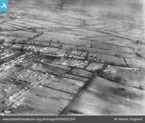
epw031254 ENGLAND (1930). Fieldend Road and environs, Eastcote, 1930.
© Copyright OpenStreetMap contributors and licensed by the OpenStreetMap Foundation. 2024. Cartography is licensed as CC BY-SA.
Nearby Images (5)
EPW031254

EPW031246

EPW044506

EPW031251

EPW031255

Details
| Title | [EPW031254] Fieldend Road and environs, Eastcote, 1930. |
| Reference | EPW031254 |
| Date | 7-February-1930 |
| Link | |
| Place name | EASTCOTE |
| Parish | |
| District | |
| Country | ENGLAND |
| Easting / Northing | 511187, 187518 |
| Longitude / Latitude | -0.39533684359413, 51.575074047904 |
| National Grid Reference | TQ112875 |
Pins
 Class31 |
Friday 19th of October 2012 08:44:01 PM | |
Class31 |
Friday 19th of October 2012 08:43:24 PM | |
Class31 |
Friday 19th of October 2012 08:43:07 PM | |
Class31 |
Friday 19th of October 2012 08:42:44 PM | |
Class31 |
Friday 19th of October 2012 08:42:15 PM | |
Class31 |
Friday 19th of October 2012 08:41:56 PM | |
Class31 |
Thursday 18th of October 2012 09:44:37 PM | |
Class31 |
Thursday 18th of October 2012 09:44:14 PM | |
Class31 |
Thursday 18th of October 2012 09:43:44 PM | |
Class31 |
Thursday 18th of October 2012 09:43:25 PM |
User Comment Contributions
Photo is of Eastcote which was in Middlesex |
Class31 |
Monday 22nd of October 2012 12:09:10 PM |


