
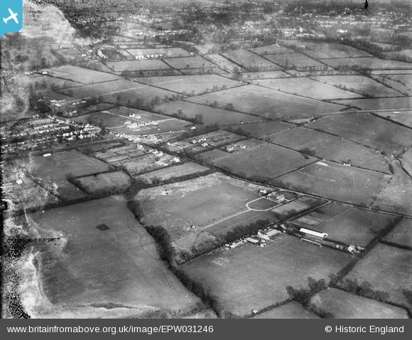
epw031246 ENGLAND (1930). The Cavendish Athletic Ground and environs, Eastcote, 1930. This image has been produced from a damaged negative.
© Copyright OpenStreetMap contributors and licensed by the OpenStreetMap Foundation. 2024. Cartography is licensed as CC BY-SA.
Nearby Images (5)
EPW031246

EPW031254

EPW044506

EPW031255

EPW031248

Details
| Title | [EPW031246] The Cavendish Athletic Ground and environs, Eastcote, 1930. This image has been produced from a damaged negative. |
| Reference | EPW031246 |
| Date | 7-February-1930 |
| Link | |
| Place name | EASTCOTE |
| Parish | |
| District | |
| Country | ENGLAND |
| Easting / Northing | 511255, 187425 |
| Longitude / Latitude | -0.39438533627101, 51.574224665166 |
| National Grid Reference | TQ113874 |
Pins
 Class31 |
Saturday 5th of January 2013 09:05:40 AM | |
Class31 |
Saturday 20th of October 2012 10:12:35 PM | |
Class31 |
Friday 19th of October 2012 08:26:52 PM | |
Class31 |
Friday 19th of October 2012 08:25:34 PM | |
Class31 |
Friday 19th of October 2012 08:25:08 PM | |
Class31 |
Thursday 18th of October 2012 09:38:47 PM | |
Class31 |
Thursday 18th of October 2012 09:38:02 PM | |
Class31 |
Thursday 18th of October 2012 09:37:27 PM | |
Class31 |
Thursday 18th of October 2012 09:36:59 PM |
User Comment Contributions
Hi Class 31, Thank you once more...rather than posting a comment to all the images in this group individually, I'll reference them here as EPW031246 to EPW031255 - we'll update the catalogue records, and post the correct location data here in due course. Yours, Katy Britain from Above Cataloguing Team Leader |
Katy Whitaker |
Wednesday 24th of October 2012 12:45:50 PM |


