
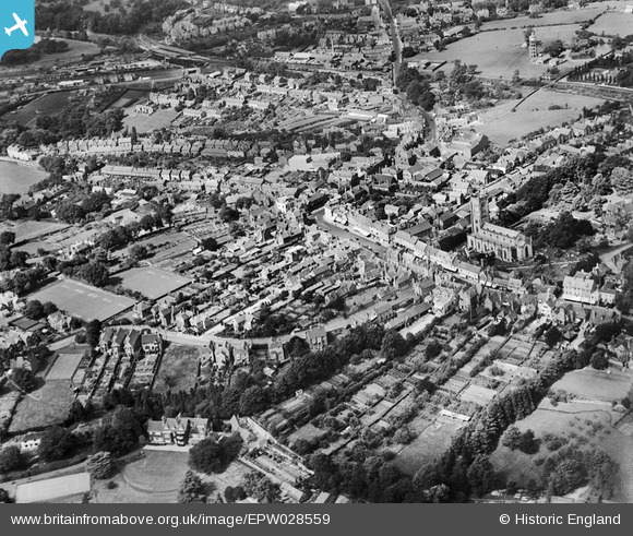
epw028559 ENGLAND (1929). St Swithin's Church and the town, East Grinstead, 1929
© Copyright OpenStreetMap contributors and licensed by the OpenStreetMap Foundation. 2024. Cartography is licensed as CC BY-SA.
Nearby Images (7)
EPW028559

EAW024790

EAW024787

EAW024789

EAW024792

EAW024788

EAW024791

Details
| Title | [EPW028559] St Swithin's Church and the town, East Grinstead, 1929 |
| Reference | EPW028559 |
| Date | August-1929 |
| Link | |
| Place name | EAST GRINSTEAD |
| Parish | EAST GRINSTEAD |
| District | |
| Country | ENGLAND |
| Easting / Northing | 539547, 137932 |
| Longitude / Latitude | -0.0057313442919747, 51.123125437669 |
| National Grid Reference | TQ395379 |
Pins
 David Posnett |
Saturday 23rd of March 2019 04:19:34 PM | |
David Posnett |
Thursday 7th of June 2018 03:36:50 PM | |
gBr |
Wednesday 24th of May 2017 02:51:09 PM | |
gBr |
Wednesday 24th of May 2017 02:48:13 PM | |
gBr |
Wednesday 24th of May 2017 02:41:16 PM | |
gBr |
Wednesday 24th of May 2017 02:40:23 PM | |
 Alan McFaden |
Sunday 19th of January 2014 04:58:59 PM | |
Alan McFaden |
Sunday 19th of January 2014 04:58:26 PM | |
Alan McFaden |
Sunday 19th of January 2014 04:57:27 PM | |
Ray Flack |
Thursday 7th of November 2013 01:31:29 PM | |
This is the "High Level" station, the "Low Level" one was on the line to Three Bridges and Tonbridge Wells which passed underneath it at right angles. |
John Wass |
Saturday 11th of April 2015 09:26:53 PM |


User Comment Contributions
 St. Swithun's Church, East Grinstead, 27/05/2016 |
 Class31 |
Friday 27th of May 2016 10:42:26 PM |


