
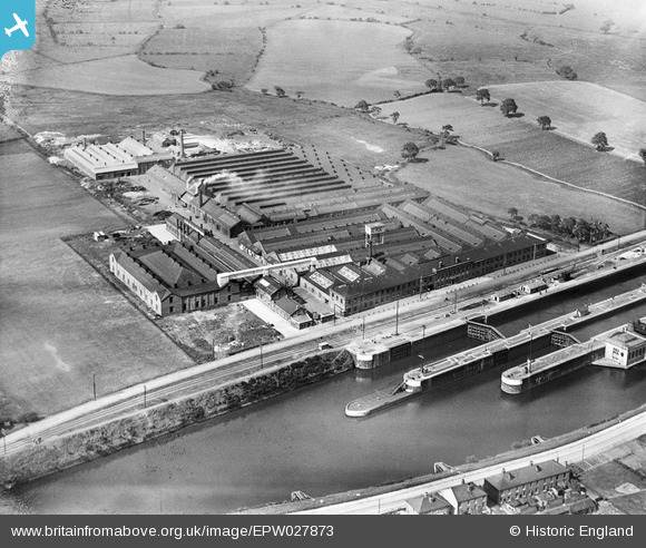
epw027873 ENGLAND (1929). The Richmond Gas Works and Latchford Locks, Latchford, 1929
© Copyright OpenStreetMap contributors and licensed by the OpenStreetMap Foundation. 2024. Cartography is licensed as CC BY-SA.
Nearby Images (8)
EPW027873

EPW027872

EPR000319

EAW008433

EPW016344A

EPR000292

EPW016344

EAW008434

Details
| Title | [EPW027873] The Richmond Gas Works and Latchford Locks, Latchford, 1929 |
| Reference | EPW027873 |
| Date | June-1929 |
| Link | |
| Place name | LATCHFORD |
| Parish | |
| District | |
| Country | ENGLAND |
| Easting / Northing | 363644, 387360 |
| Longitude / Latitude | -2.5466203497832, 53.381572702451 |
| National Grid Reference | SJ636874 |
Pins
Be the first to add a comment to this image!
User Comment Contributions
The Richmond works converted to a bombmaking facility during World War Two. My Mum was employed there - drilling holes in bomb casings. On the left (west of factory) can be seen open fields. In the 1930s Warrington Corporation built a large housing estate there and moved people out of the slums of Warrington town centre. In 1935 my grandparents (although not living in a slum) got an opportunity to take one of these new 'Corporation' houses and were thrilled to move to a smart, clean, modern house which had an indoor toilet and a bathroom! As a result, when war came and my Mum (then still in her teens) sought work, she was able to take a useful job within walking distance of her home. |
 SusanW |
Sunday 9th of December 2012 01:31:17 AM |


