
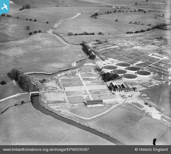
epw026087 ENGLAND (1929). The Ashford Urban District Council Sewage Works and the Great Stour, Ashford, 1929
© Copyright OpenStreetMap contributors and licensed by the OpenStreetMap Foundation. 2024. Cartography is licensed as CC BY-SA.
Nearby Images (2)
EPW026087

EPW041209

Details
| Title | [EPW026087] The Ashford Urban District Council Sewage Works and the Great Stour, Ashford, 1929 |
| Reference | EPW026087 |
| Date | 19-April-1929 |
| Link | |
| Place name | ASHFORD |
| Parish | |
| District | |
| Country | ENGLAND |
| Easting / Northing | 601891, 143562 |
| Longitude / Latitude | 0.88735926761454, 51.1551178066 |
| National Grid Reference | TR019436 |
Pins
Be the first to add a comment to this image!


