
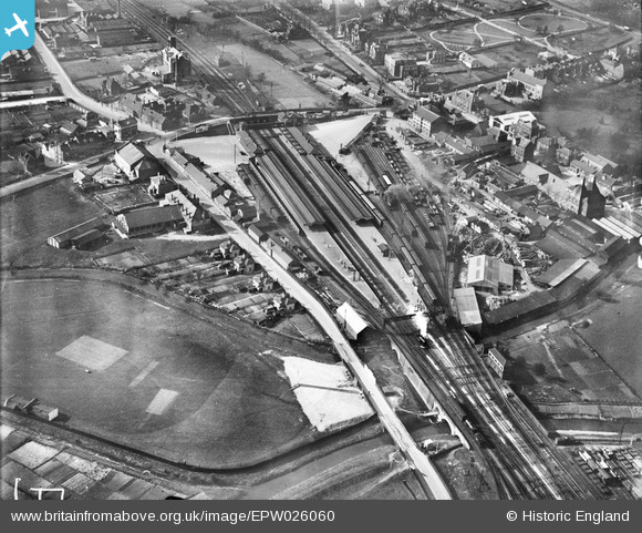
epw026060 ENGLAND (1929). Ashford railway station and environs, Ashford, 1929
© Copyright OpenStreetMap contributors and licensed by the OpenStreetMap Foundation. 2024. Cartography is licensed as CC BY-SA.
Nearby Images (4)
EPW026060

EPW001441

EPW007029

EAW008281

Details
| Title | [EPW026060] Ashford railway station and environs, Ashford, 1929 |
| Reference | EPW026060 |
| Date | April-1929 |
| Link | |
| Place name | ASHFORD |
| Parish | |
| District | |
| Country | ENGLAND |
| Easting / Northing | 601224, 142128 |
| Longitude / Latitude | 0.8770314462688, 51.14247299654 |
| National Grid Reference | TR012421 |
Pins
 Trevor.bd2 |
Thursday 9th of September 2021 04:05:49 PM | |
Bushy |
Tuesday 16th of April 2019 10:30:44 PM | |
Bushy |
Tuesday 16th of April 2019 10:25:04 PM | |
Stu Giles |
Wednesday 27th of June 2018 08:26:37 PM | |
B.R.E.L.I.E. |
Sunday 6th of April 2014 08:37:43 PM | |
B.R.E.L.I.E. |
Sunday 6th of April 2014 08:36:53 PM | |
B.R.E.L.I.E. |
Thursday 3rd of April 2014 08:53:47 PM |


