
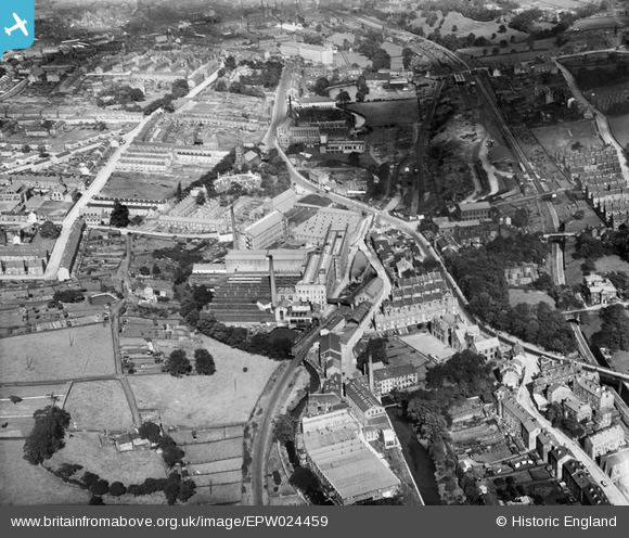
epw024459 ENGLAND (1928). Robert Clough Grove Worsted Mills and environs, Ingrow, 1928
© Copyright OpenStreetMap contributors and licensed by the OpenStreetMap Foundation. 2024. Cartography is licensed as CC BY-SA.
Nearby Images (3)
EPW024459

EPW024457

EPW024460

Details
| Title | [EPW024459] Robert Clough Grove Worsted Mills and environs, Ingrow, 1928 |
| Reference | EPW024459 |
| Date | September-1928 |
| Link | |
| Place name | INGROW |
| Parish | KEIGHLEY |
| District | |
| Country | ENGLAND |
| Easting / Northing | 405511, 439638 |
| Longitude / Latitude | -1.9162135038607, 53.852736582763 |
| National Grid Reference | SE055396 |
Pins
 J May |
Wednesday 11th of July 2018 07:32:37 PM | |
John W |
Sunday 1st of May 2016 12:11:34 PM | |
Philip |
Saturday 15th of November 2014 08:17:56 PM | |
This was Ingrow East station on the Great Northern branch railway that ran from Halifax via Queensbury and down to Keighley - the GN had its own goods yard but shared passenger platforms with the Midland Railway. The connection between the two lines was about halfway between Keighley and Ingrow stations. British Railways withdrew the passenger service in May 1955. Goods traffic lasted for another year or so. |
John W |
Sunday 1st of May 2016 12:28:30 PM |
Philip |
Saturday 15th of November 2014 08:16:17 PM |


