
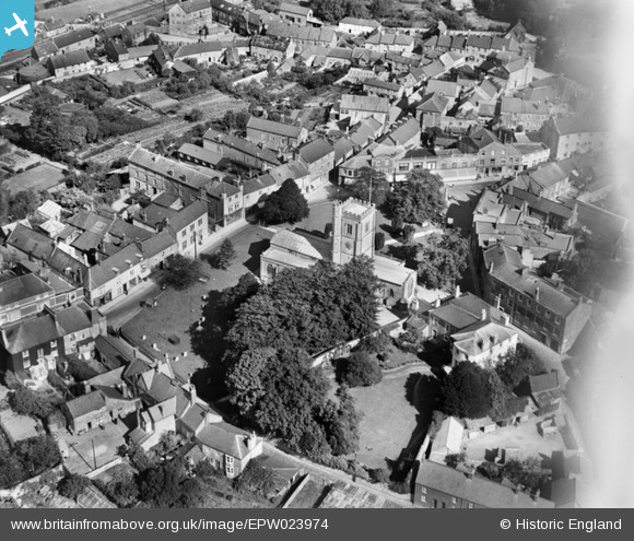
epw023974 ENGLAND (1928). St Mary's Church, Axminster, 1928
© Copyright OpenStreetMap contributors and licensed by the OpenStreetMap Foundation. 2024. Cartography is licensed as CC BY-SA.
Nearby Images (5)
EPW023974

EPW024056

EPW023973

EPW023975

EPW023979

Details
| Title | [EPW023974] St Mary's Church, Axminster, 1928 |
| Reference | EPW023974 |
| Date | September-1928 |
| Link | |
| Place name | AXMINSTER |
| Parish | AXMINSTER |
| District | |
| Country | ENGLAND |
| Easting / Northing | 329638, 98484 |
| Longitude / Latitude | -2.9981586289401, 50.781091470583 |
| National Grid Reference | SY296985 |
Pins
 Kentishman |
Wednesday 9th of January 2019 03:54:06 PM | |
Kentishman |
Wednesday 9th of January 2019 03:48:16 PM | |
Kentishman |
Wednesday 9th of January 2019 03:46:27 PM | |
Kentishman |
Wednesday 9th of January 2019 03:41:40 PM | |
Kentishman |
Wednesday 9th of January 2019 03:38:38 PM | |
 Class31 |
Monday 10th of February 2014 09:46:15 AM | |
Class31 |
Monday 10th of February 2014 09:45:19 AM | |
Class31 |
Monday 10th of February 2014 09:42:52 AM | |
Class31 |
Monday 10th of February 2014 09:40:43 AM | |
Class31 |
Monday 10th of February 2014 09:39:31 AM | |
Class31 |
Monday 10th of February 2014 09:14:42 AM | |
Class31 |
Monday 10th of February 2014 09:05:26 AM |


User Comment Contributions
 St. Mary's Church and War Memorial 09/02/2014 |
Class31 |
Monday 10th of February 2014 08:48:57 AM |


