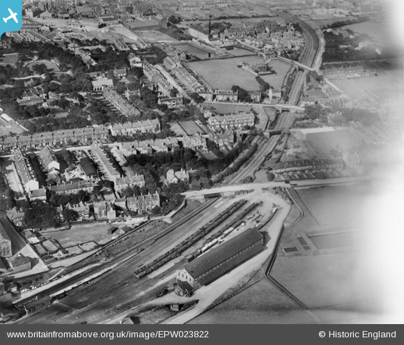
epw023822 ENGLAND (1928). Goods shed and railway sidings, Pudsey, 1928
© Copyright OpenStreetMap contributors and licensed by the OpenStreetMap Foundation. 2025. Cartography is licensed as CC BY-SA.
Nearby Images (5)
Details
| Title | [EPW023822] Goods shed and railway sidings, Pudsey, 1928 |
| Reference | EPW023822 |
| Date | September-1928 |
| Link | |
| Place name | PUDSEY |
| Parish | |
| District | |
| Country | ENGLAND |
| Easting / Northing | 422236, 432822 |
| Longitude / Latitude | -1.6624307950031, 53.791021866875 |
| National Grid Reference | SE222328 |
Pins
 James |
Sunday 15th of January 2023 06:18:06 PM | |
 David Arundale |
Sunday 21st of February 2021 10:23:13 PM | |
 bigallan |
Friday 10th of May 2013 07:24:38 PM |
User Comment Contributions
This is Pudsey Greenside station. Pudsey Lowtown is just off the top of the picture. This is at 159m - quite a climb from Leeds Central at abt 30m. Immediately after leaving this station there was a tunnel about 750m followed by a high embankment of abt 1.3km. A lot of engineering for a small line! |
 Mike Harrison |
Sunday 1st of July 2012 07:45:20 PM |


![[EPW023822] Goods shed and railway sidings, Pudsey, 1928](http://britainfromabove.org.uk/sites/all/libraries/aerofilms-images/public/100x100/EPW/023/EPW023822.jpg)
![[EPW034282] New Street Cotton Mills and environs, Pudsey, from the south, 1930](http://britainfromabove.org.uk/sites/all/libraries/aerofilms-images/public/100x100/EPW/034/EPW034282.jpg)
![[EPW023818] New Street Cotton Mills and the railway station, Pudsey, 1928](http://britainfromabove.org.uk/sites/all/libraries/aerofilms-images/public/100x100/EPW/023/EPW023818.jpg)
![[EPW034283] St Lawrence's Church and environs, Pudsey, from the south, 1930](http://britainfromabove.org.uk/sites/all/libraries/aerofilms-images/public/100x100/EPW/034/EPW034283.jpg)
![[EPW023819] St Lawrence's Church and Pudsey Park, Pudsey, 1928](http://britainfromabove.org.uk/sites/all/libraries/aerofilms-images/public/100x100/EPW/023/EPW023819.jpg)