
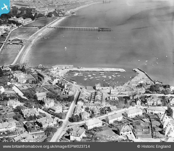
epw023714 ENGLAND (1928). Paignton Harbour and Paignton Sands, Paignton, 1928
© Copyright OpenStreetMap contributors and licensed by the OpenStreetMap Foundation. 2024. Cartography is licensed as CC BY-SA.
Nearby Images (2)
EPW023714

EAW007579

Details
| Title | [EPW023714] Paignton Harbour and Paignton Sands, Paignton, 1928 |
| Reference | EPW023714 |
| Date | September-1928 |
| Link | |
| Place name | PAIGNTON |
| Parish | |
| District | |
| Country | ENGLAND |
| Easting / Northing | 289500, 60357 |
| Longitude / Latitude | -3.556023960133, 50.43204834363 |
| National Grid Reference | SX895604 |
Pins
Be the first to add a comment to this image!


