
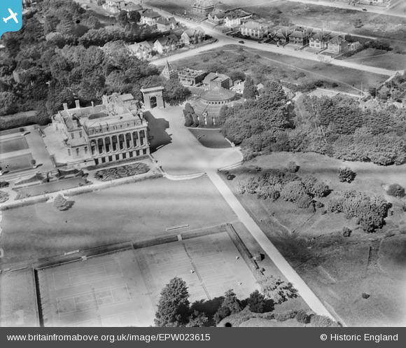
epw023615 ENGLAND (1928). The Torbay Country Club at Oldway, Paignton, 1928
© Copyright OpenStreetMap contributors and licensed by the OpenStreetMap Foundation. 2024. Cartography is licensed as CC BY-SA.
Details
| Title | [EPW023615] The Torbay Country Club at Oldway, Paignton, 1928 |
| Reference | EPW023615 |
| Date | September-1928 |
| Link | |
| Place name | PAIGNTON |
| Parish | |
| District | |
| Country | ENGLAND |
| Easting / Northing | 288833, 61559 |
| Longitude / Latitude | -3.5657692570028, 50.442729312593 |
| National Grid Reference | SX888616 |
Pins

User Comment Contributions
 I have been wondering what the round building next to the main house was and have found this image of what it looks like today! Apparently, it was built in 1874 and originally used as a horse riding exercise arena. Then a bid to turn it into a drama centre failed in the 1990s. Does anybody know if it is being used today? I would love to have a look inside! http://www.geograph.org.uk/photo/692992 Photo copyright: Tom Jolliffe |
Sandra Brauer |
Friday 10th of January 2014 03:19:29 PM |


