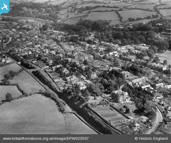
epw023597 ENGLAND (1928). The town and environs, Tavistock, from the west, 1928
© Copyright OpenStreetMap contributors and licensed by the OpenStreetMap Foundation. 2024. Cartography is licensed as CC BY-SA.
Nearby Images (2)
EPW023597

EPW023603

Details
| Title | [EPW023597] The town and environs, Tavistock, from the west, 1928 |
| Reference | EPW023597 |
| Date | September-1928 |
| Link | |
| Place name | TAVISTOCK |
| Parish | TAVISTOCK |
| District | |
| Country | ENGLAND |
| Easting / Northing | 247528, 74259 |
| Longitude / Latitude | -4.1523498295198, 50.547595013419 |
| National Grid Reference | SX475743 |