
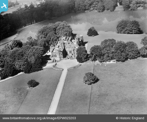
epw023203 ENGLAND (1928). Sherborne Castle, Sherborne, 1928
© Copyright OpenStreetMap contributors and licensed by the OpenStreetMap Foundation. 2024. Cartography is licensed as CC BY-SA.
Nearby Images (3)
EPW023203

EPW023209

EPW023210

Details
| Title | [EPW023203] Sherborne Castle, Sherborne, 1928 |
| Reference | EPW023203 |
| Date | September-1928 |
| Link | |
| Place name | SHERBORNE |
| Parish | CASTLETON |
| District | |
| Country | ENGLAND |
| Easting / Northing | 364939, 116390 |
| Longitude / Latitude | -2.4991237448425, 50.945332897828 |
| National Grid Reference | ST649164 |
Pins
Be the first to add a comment to this image!


