
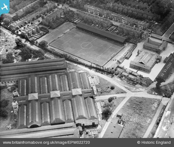
epw022720 ENGLAND (1928). Queen's Park Rangers FC Football Ground at Loftus Road, Shepherd's Bush, 1928
© Copyright OpenStreetMap contributors and licensed by the OpenStreetMap Foundation. 2024. Cartography is licensed as CC BY-SA.
Nearby Images (7)
EPW022720

EAW005411

EPW022719

EPW062152

EAW005413

EAW005410

EPW022570

Details
| Title | [EPW022720] Queen's Park Rangers FC Football Ground at Loftus Road, Shepherd's Bush, 1928 |
| Reference | EPW022720 |
| Date | August-1928 |
| Link | |
| Place name | SHEPHERD'S BUSH |
| Parish | |
| District | |
| Country | ENGLAND |
| Easting / Northing | 522737, 180447 |
| Longitude / Latitude | -0.23119401691423, 51.509122078683 |
| National Grid Reference | TQ227804 |
Pins
User Comment Contributions
 QPR Loftus Road 1928 |
 Paulie |
Saturday 7th of July 2012 04:11:41 PM |


