
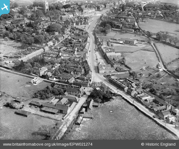
epw021274 ENGLAND (1928). Lynn Street and the town centre, Swaffham, 1928
© Copyright OpenStreetMap contributors and licensed by the OpenStreetMap Foundation. 2024. Cartography is licensed as CC BY-SA.
Nearby Images (3)
EPW021274

EPW021277

EPW021275

Details
| Title | [EPW021274] Lynn Street and the town centre, Swaffham, 1928 |
| Reference | EPW021274 |
| Date | May-1928 |
| Link | |
| Place name | SWAFFHAM |
| Parish | SWAFFHAM |
| District | |
| Country | ENGLAND |
| Easting / Northing | 581660, 309170 |
| Longitude / Latitude | 0.68570353482065, 52.649443524837 |
| National Grid Reference | TF817092 |
Pins
 Froggiepond |
Wednesday 2nd of March 2022 02:10:15 PM | |
Froggiepond |
Wednesday 2nd of March 2022 02:09:20 PM | |
Froggiepond |
Wednesday 2nd of March 2022 02:08:36 PM | |
Froggiepond |
Wednesday 2nd of March 2022 02:08:06 PM | |
totoro |
Sunday 5th of July 2015 09:17:18 PM | |
 |
totoro |
Sunday 5th of July 2015 08:48:00 PM |
 melgibbs |
Saturday 5th of April 2014 06:28:47 PM |


