
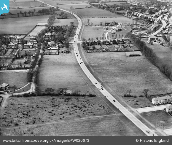
epw020673 ENGLAND (1928). The Kingston Bypass, Motspur Park, 1928
© Copyright OpenStreetMap contributors and licensed by the OpenStreetMap Foundation. 2024. Cartography is licensed as CC BY-SA.
Nearby Images (3)
EPW020673

EPW020676

EPW017150

Details
| Title | [EPW020673] The Kingston Bypass, Motspur Park, 1928 |
| Reference | EPW020673 |
| Date | March-1928 |
| Link | |
| Place name | MOTSPUR PARK |
| Parish | |
| District | |
| Country | ENGLAND |
| Easting / Northing | 521775, 167703 |
| Longitude / Latitude | -0.24943843767424, 51.394782483916 |
| National Grid Reference | TQ218677 |
Pins
 Laurie |
Saturday 23rd of January 2016 07:19:34 PM | |
Laurie |
Saturday 23rd of January 2016 07:18:37 PM | |
Laurie |
Saturday 23rd of January 2016 07:16:33 PM | |
 Maurice |
Wednesday 23rd of January 2013 08:22:05 AM |
User Comment Contributions
Also see EPW020677 |
Maurice |
Wednesday 23rd of January 2013 08:48:06 AM |


