
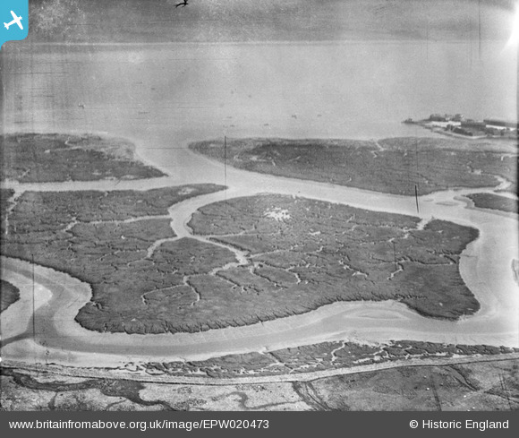
epw020473 ENGLAND (1928). Ower Lake and Calshot Castle, Calshot, from the south-west, 1928
© Copyright OpenStreetMap contributors and licensed by the OpenStreetMap Foundation. 2024. Cartography is licensed as CC BY-SA.
Nearby Images (2)
EPW020473

EPW020507

Details
| Title | [EPW020473] Ower Lake and Calshot Castle, Calshot, from the south-west, 1928 |
| Reference | EPW020473 |
| Date | 16-March-1928 |
| Link | |
| Place name | CALSHOT |
| Parish | FAWLEY |
| District | |
| Country | ENGLAND |
| Easting / Northing | 447793, 102190 |
| Longitude / Latitude | -1.3214942057561, 50.816719539254 |
| National Grid Reference | SU478022 |
Pins
Be the first to add a comment to this image!
User Comment Contributions
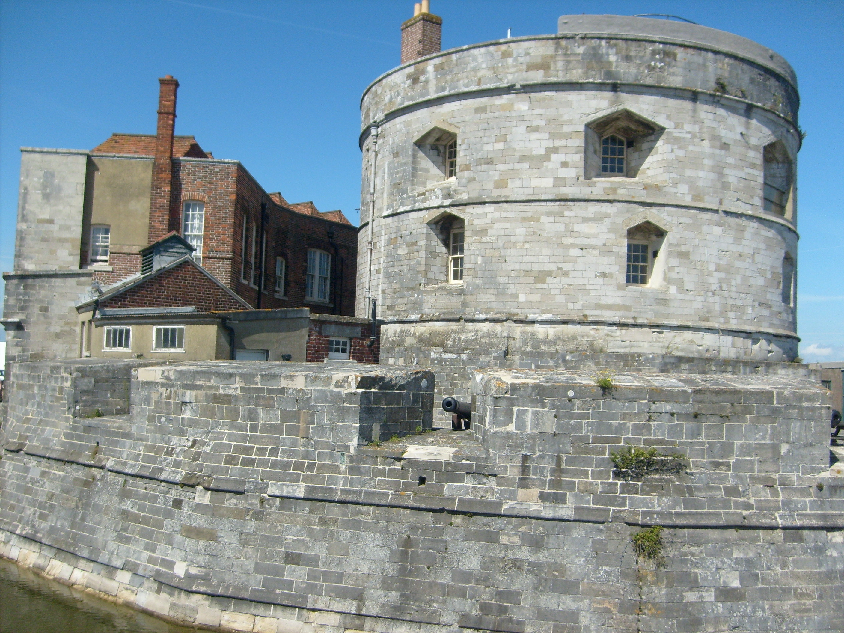 Calshot Castle, 23/08/2014 |
 Class31 |
Monday 10th of November 2014 03:48:35 PM |


