
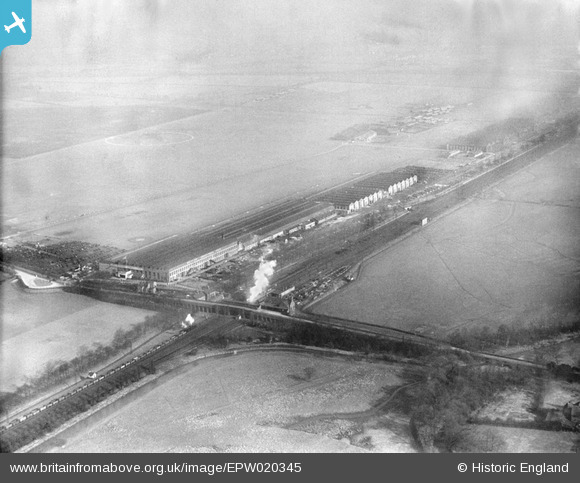
epw020345 ENGLAND (1928). British Industries Fair Exhibition Hall, Castle Bromwich, from the south-west, 1928
© Copyright OpenStreetMap contributors and licensed by the OpenStreetMap Foundation. 2024. Cartography is licensed as CC BY-SA.
Nearby Images (13)
EPW020345

EPW020347

EPW020353

EPW020346

EPW020346
EPW020349

EPW020350

EPW020351

EPW020352

EPW020352
EPW020348

EPW007488

EAW015287

Details
| Title | [EPW020345] British Industries Fair Exhibition Hall, Castle Bromwich, from the south-west, 1928 |
| Reference | EPW020345 |
| Date | 28-February-1928 |
| Link | |
| Place name | CASTLE BROMWICH |
| Parish | |
| District | |
| Country | ENGLAND |
| Easting / Northing | 413853, 290343 |
| Longitude / Latitude | -1.7958604118372, 52.510436158277 |
| National Grid Reference | SP139903 |
Pins
 frothy |
Monday 16th of January 2023 03:24:02 PM | |
 Billy Turner |
Tuesday 18th of October 2016 05:39:37 PM | |
 PURCELL |
Wednesday 20th of November 2013 08:18:46 AM | |
Blockbell |
Wednesday 11th of July 2012 02:56:36 PM |


