
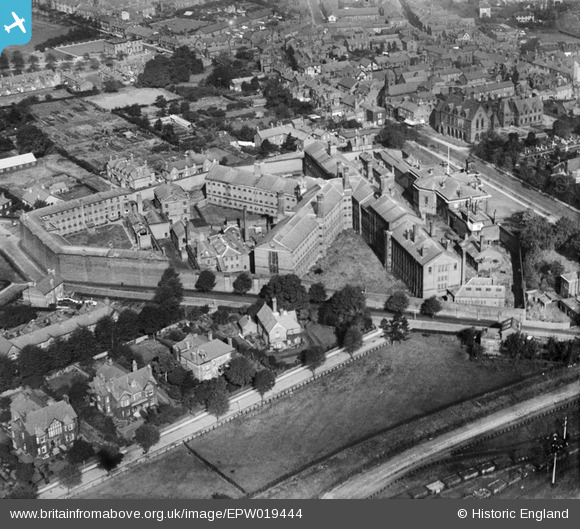
epw019444 ENGLAND (1927). The prison and Court House, Knutsford, 1927
© Copyright OpenStreetMap contributors and licensed by the OpenStreetMap Foundation. 2024. Cartography is licensed as CC BY-SA.
Nearby Images (3)
EPW019444

EAW050496

EPW019443

Details
| Title | [EPW019444] The prison and Court House, Knutsford, 1927 |
| Reference | EPW019444 |
| Date | October-1927 |
| Link | |
| Place name | KNUTSFORD |
| Parish | KNUTSFORD |
| District | |
| Country | ENGLAND |
| Easting / Northing | 375092, 378371 |
| Longitude / Latitude | -2.3737948137214, 53.301429978973 |
| National Grid Reference | SJ751784 |
Pins
 Ian Warburton |
Sunday 28th of December 2014 05:34:59 PM | |
Ian Warburton |
Sunday 28th of December 2014 05:30:51 PM | |
Ian Warburton |
Sunday 28th of December 2014 05:07:33 PM | |
Ian Warburton |
Sunday 28th of December 2014 05:07:01 PM | |
Ian Warburton |
Sunday 28th of December 2014 05:06:29 PM | |
Ian Warburton |
Sunday 28th of December 2014 05:03:58 PM | |
Ian Warburton |
Sunday 28th of December 2014 04:25:15 PM |


