
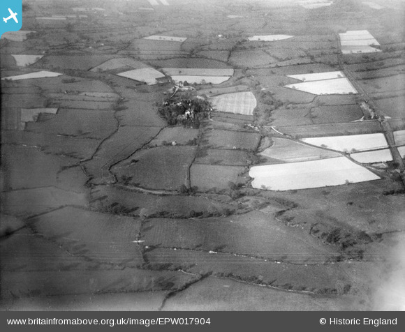
epw017904 ENGLAND (1927). Countryside around Eaton Brook, Rushbury, from the south-west, 1927
© Copyright OpenStreetMap contributors and licensed by the OpenStreetMap Foundation. 2024. Cartography is licensed as CC BY-SA.
Nearby Images (6)
EPW017904

EPW017907

EPW017901

EPW017896

EPW017906

EPW017895

Details
| Title | [EPW017904] Countryside around Eaton Brook, Rushbury, from the south-west, 1927 |
| Reference | EPW017904 |
| Date | 11-May-1927 |
| Link | |
| Place name | RUSHBURY |
| Parish | RUSHBURY |
| District | |
| Country | ENGLAND |
| Easting / Northing | 350789, 291364 |
| Longitude / Latitude | -2.725301672228, 52.517569627831 |
| National Grid Reference | SO508914 |
Pins
User Comment Contributions
See also EPW017891 to EPW017905 (excluding EPW017903) |
 BigglesH |
Monday 23rd of July 2012 07:20:36 PM |
Looking North East up Ape Dale with Rushbury village with St. Peter's Parish Church tower in the foreground. Manor Farm is beyond Rushbury village. The Craven Arms - Much Wenlock Great wEstern Railway line serves Rushbury Station in shot. |
 Class31 |
Thursday 5th of July 2012 10:21:12 AM |


