
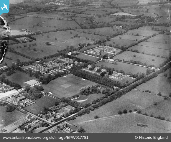
epw017781 ENGLAND (1927). Manchester Royal Mental Hospital, Cheadle, 1927
© Copyright OpenStreetMap contributors and licensed by the OpenStreetMap Foundation. 2024. Cartography is licensed as CC BY-SA.
Nearby Images (8)
EPW017781

EPW017784

EPW017777

EPW017783

EPW017779

EPW017778

EPW017782

EPW017785

Details
| Title | [EPW017781] Manchester Royal Mental Hospital, Cheadle, 1927 |
| Reference | EPW017781 |
| Date | April-1927 |
| Link | |
| Place name | CHEADLE |
| Parish | |
| District | |
| Country | ENGLAND |
| Easting / Northing | 385448, 386541 |
| Longitude / Latitude | -2.2187593284238, 53.375261081649 |
| National Grid Reference | SJ854865 |
Pins
 Ian Warburton |
Friday 26th of December 2014 04:36:32 PM | |
stantondavies |
Saturday 30th of August 2014 07:28:30 PM | |
stantondavies |
Saturday 30th of August 2014 07:22:53 PM | |
HVC |
Wednesday 2nd of October 2013 09:48:27 PM | |
HVC |
Tuesday 4th of September 2012 08:18:04 PM | |
HVC |
Friday 27th of July 2012 12:50:32 PM | |
HVC |
Friday 27th of July 2012 11:35:36 AM | |
HVC |
Friday 27th of July 2012 11:30:50 AM | |
Lower house farm... |
HVC |
Tuesday 4th of September 2012 05:53:02 PM |
HVC |
Friday 27th of July 2012 11:27:18 AM | |
I think this is more likely to be the 'Dale' estate? |
chuffmeister |
Saturday 16th of March 2013 11:43:44 PM |
If you follow the line of the hedge/path from where the High Grove pub now stands towards the railway line it coincides with the path that runs along the edge of the golf course.. there's also a hedge line that runs along what is now Grassmere rd, the third field from st annes rd is where High Grove infants school stood.. the golf course butted up to the school grounds. to the rear of the houses on the modern day Grassmere rd was a thin line of know-mans land which may have been a path at one time. it was about 3 ft wide.. this was in the early 80's. |
HVC |
Wednesday 2nd of October 2013 09:47:29 PM |
HVC |
Friday 27th of July 2012 11:26:41 AM | |
Another local house that burned down. |
HVC |
Friday 27th of July 2012 11:44:27 AM |
HVC |
Friday 27th of July 2012 11:26:08 AM | |
HVC |
Friday 27th of July 2012 11:25:41 AM | |
HVC |
Friday 27th of July 2012 11:23:19 AM | |
HVC |
Friday 27th of July 2012 11:22:54 AM | |
HVC |
Friday 27th of July 2012 11:22:11 AM | |
HVC |
Friday 27th of July 2012 11:20:16 AM | |
I grew up in a modern house built here.. in the 70's my dad unearthed a cobbled path and some clay pipes while digging the garden.. for years we still had a pair of Barn Owls visit the old Oak trees at the back of the house. |
HVC |
Friday 27th of July 2012 11:42:36 AM |
HVC |
Friday 27th of July 2012 11:18:58 AM | |
Bought by a local builder in the early 80's and burned down shortly after..??? Later that year the same local builder built a modern house on the site. |
HVC |
Friday 27th of July 2012 11:38:59 AM |


