
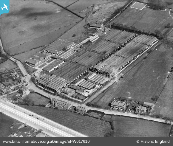
epw017610 ENGLAND (1927). Burnage Cycle and Driving Chains Works, Burnage, 1927
© Copyright OpenStreetMap contributors and licensed by the OpenStreetMap Foundation. 2024. Cartography is licensed as CC BY-SA.
Details
| Title | [EPW017610] Burnage Cycle and Driving Chains Works, Burnage, 1927 |
| Reference | EPW017610 |
| Date | April-1927 |
| Link | |
| Place name | BURNAGE |
| Parish | |
| District | |
| Country | ENGLAND |
| Easting / Northing | 386020, 391394 |
| Longitude / Latitude | -2.2103755954935, 53.41890284515 |
| National Grid Reference | SJ860914 |
Pins
 Steve |
Sunday 5th of January 2020 02:16:21 AM | |
John Ellis |
Thursday 30th of January 2014 11:12:30 AM | |
petegarv |
Tuesday 22nd of October 2013 08:53:39 PM | |
John Ellis |
Sunday 14th of October 2012 12:47:18 PM | |
John Ellis |
Sunday 14th of October 2012 12:46:38 PM | |
John Ellis |
Sunday 14th of October 2012 12:44:28 PM | |
John Ellis |
Sunday 14th of October 2012 12:43:28 PM | |
John Ellis |
Sunday 14th of October 2012 12:42:54 PM |


